

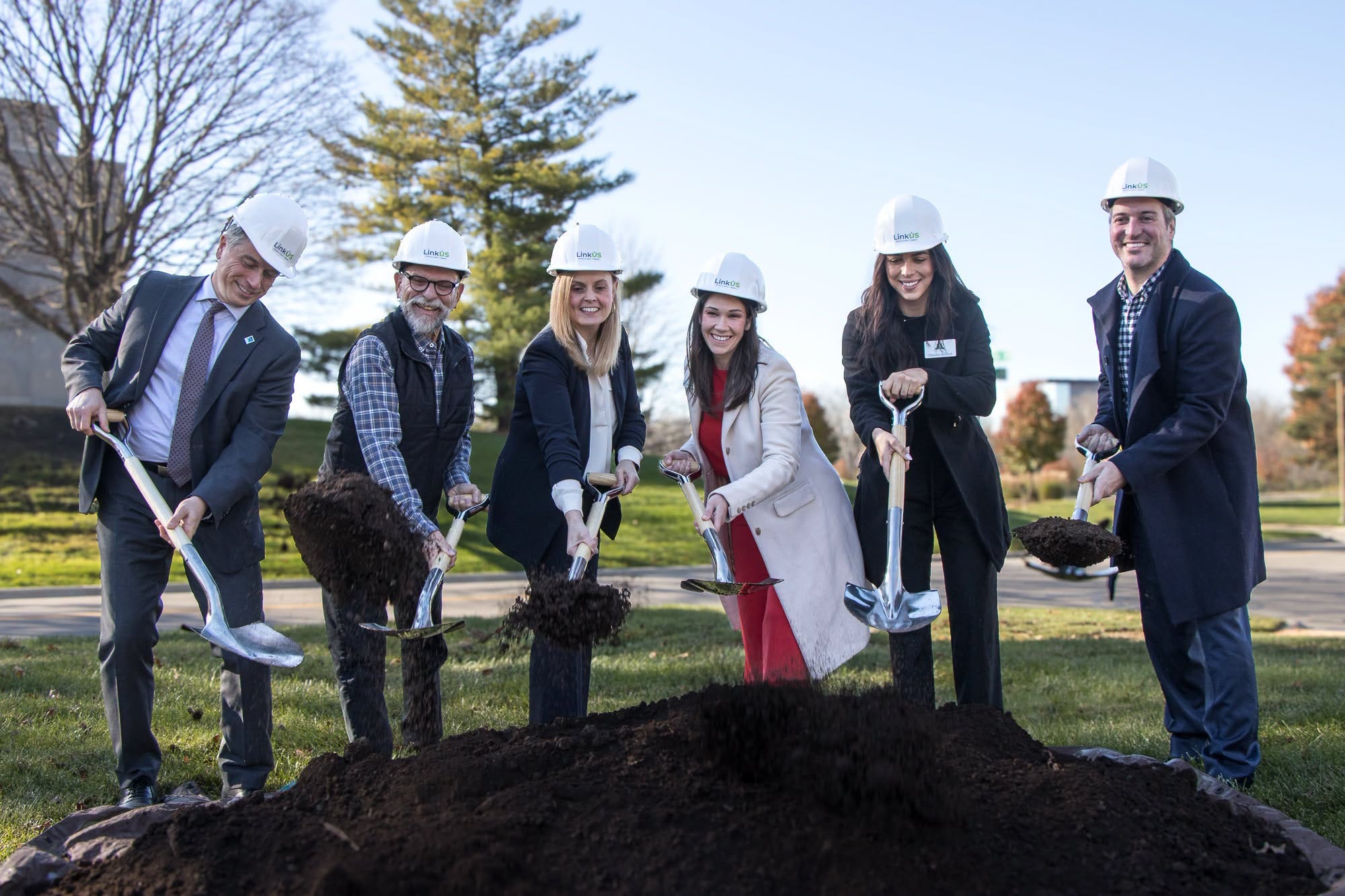
This week, I joined the groundbreaking ceremony for Westerville’s $3.2 million Brooksedge Mobility Project, in the northern Columbus suburb. The project moves Ohio to Erie Trail users off busy, five-lane Schrock Road and onto a bikeway along quiet office park streets.
That may not be many people’s idea of an epic “closing the gap” project. There won’t be miles of an asphalt trail winding through the woods. Instead, the project adds 4,600 feet of 10-foot shared-use path through an office park, creating a safer, enjoyable trail connection.
Make no mistake. This isn’t just about building a trail. More specifically, it’s about closing a much-needed gap, measured by safety rather than miles.
Holding the shovel at the groundbreaking, I thought about what closing gaps along the Ohio to Erie Trail really means.
The Goal of a Continuous Trail
A long-standing Ohio to Erie Trail goal has been creating a continuous, on-trail, off-road experience connecting the Ohio River in Cincinnati with Lake Erie in Cleveland.
That was what Ed Honton, the visionary behind the Ohio to Erie Trail, dreamed of. Today, approximately 300 miles offer an off-road, on-trail experience, with fewer miles remaining on roads and streets.
That’s an extraordinary accomplishment for a vision that began in 1991. An accomplishment that took thirty-five years
Over the years, considerable effort has gone into replacing on-road connections with dedicated trail. Today, some of the most ambitious work is taking place at the route’s two ends, where advocates are working toward a continuous trail through Cincinnati and Cleveland.
Those projects offer tremendous potential to reach the goal. Not every gap presents the same opportunities, and not every solution looks alike.
Some Gaps Are Harder to Close
Perhaps the most familiar example of a challenging Ohio to Erie Trail gap is the on-road route through Wayne County’s Amish country.
For years, advocates have worked to move the route off country roads and onto a dedicated trail. There has been progress in the county’s northern portion. The southern portion continues to present private property rights challenges.
It’s complicated. Wanting a trail and finding a workable route for everyone involved are two different things. I would love to see a continuous off-road trail through Wayne County. Property rights matter, and dreams and enthusiasm alone don’t resolve sticky issues.
The encouraging part is that local advocates haven’t given up. They continue building what they can and looking for ways to improve the route. Their persistence deserves recognition, even when progress doesn’t come as quickly as the rest of us might like.
Road connections in rural towns present their own challenges. In London, work is progressing to turn streets into a trail. Other efforts call for differing approaches, possibly remaining on streets with better infrastructure.
When the Trails Enter a City
The Ohio to Erie Trail passes through Cincinnati, Columbus, Akron, and Cleveland, where urban settings present a different set of challenges.
Former railroad and canal corridors provided wonderful opportunities for longer trail sections. Where those corridors have disappeared beneath development, streets, and buildings, recreating them isn’t simple.
Closing a trail gap may mean using shared-use paths along streets. It looks different from what we traditionally picture as a trail, but it offers an equally valuable trail experience.
Rather than viewing these approaches as a compromise, we should judge them by the experience they provide. A successful gap closure creates a safe, accessible, and enjoyable connection, regardless of what we traditionally think of as a trail.
Columbus: A Visionary Connection
LinkUS, Columbus’s ambitious transportation vision, is creating a more connected city for people walking, biking, and using public transit. For Ohio to Erie Trail users, an exciting vision is a downtown loop making more of what Columbus has to offer accessible.
The idea goes beyond a route through downtown. It makes downtown part of the trail experience. A loop would encompass the Arena District, provide access to the Short North, and connect riders with the Ohio Statehouse, downtown businesses, hotels, restaurants, and cultural attractions.
Another proposal turns Broad Street into a landscaped corridor with a protected bike lane, linking the Scioto Greenway with the Alum Creek Trail and opening up access to Franklin Park and other destinations along the way.
Imagine arriving in Columbus by trail and having a safe, easy-to-follow connection to places to eat, stay, explore, and enjoy. A visit to the Statehouse or a side trip into the Short North becomes part of the journey, not a detour.
The value is more than moving people across downtown. It’s connecting trail users with the city and allowing local businesses and attractions to welcome visitors arriving by trail.
That’s a win for Columbus and a win for the Ohio to Erie Trail. The approach may look different from traditional trail building. But the goal remains the same: creating safe, accessible, enjoyable connections that make the places along the way part of the experience.
Cincinnati and Cleveland Reclaiming the Past
In Cincinnati and Cleveland, the opportunities take a different form. The vision is to reclaim historic transportation corridors and create a continuous, memorable trail experience.
In Cincinnati, an abandoned riverfront rail corridor is being transformed into a trail connecting to the Little Miami Scenic Trail, linking neighborhoods while offering visitors a unique perspective of the Ohio River.
In Cleveland, it’s reclaiming the Ohio and Erie Canal towpath, buried beneath city streets in the Flats, and creating a trail to the mouth of the Cuyahoga River at Lake Erie. It offers a memorable beginning or ending to a cross-state journey.
There’s something satisfying about that. Corridors that once moved goods and people by train and canal boat serve a new generation traveling by bicycle and on foot.
These projects reflect the value of preserving history. Reminding us why no single approach closes every gap. Different communities have different histories, available spaces, and practical choices.
Rethinking the Meaning of Closing Gaps
The Ohio to Erie Trail likely will never be 100% off-road and a traditional rail-trail and canal towpath from end to end. That doesn’t diminish the vision of Ed Honton, the father of the Trail. I suspect he would see this blend of history, practicality, adventure, and enjoyment as a fitting realization of his vision set in motion 35 years ago.
In some places, a former railroad corridor provides the best solution. Elsewhere, it may be a side path or protected bicycle lane. In another community, quieter streets, safer crossings, and pedestrian and bicycle infrastructure make the most sense.
What matters is the experience. When I ride, I want to enjoy the journey. I want to feel comfortable, not worrying about fast-moving vehicles on a narrow, busy road. I want to stop in towns and discover their uniqueness.
A traditional trail can provide that experience. It isn’t the only way. The important distinction isn’t just road versus trail. It’s whether the connection works well for the people using it.
Progress Deserves Recognition
That’s why we should celebrate improvements even when they don’t look exactly like what we originally envisioned.
For those of us who ride through Westerville, this project makes a real difference. It’s also part of a broader effort to make the community more welcoming to trail users and residents alike.
The work in Columbus, Cincinnati, and Cleveland deserves recognition. These are complicated environments. Better connections require cooperation, investment, patience, and a willingness to consider alternatives.
Smaller improvements matter just as much to the person encountering them: a safer crossing, a clearer connection, or a short stretch moved away from heavy traffic.
In Wayne County, I remain realistic about the obstacles and appreciative of the people working on them. Whether the route through the county moves off-road remains to be seen. In the meantime, improving the experience is worthwhile. We don’t have to wait for the final solution to recognize progress.
The Real Meaning of Mind the Gap
Perhaps minding the gap is finding ways to replace on-road miles with solutions that go beyond our traditional view of a trail, removing barriers and making the journey safer, more accessible, and more enjoyable.
Will we reach 100% off-road? Probably not. If we reach the high 90s while making the remaining connections safe, comfortable, and enjoyable, I consider that a tremendous achievement.
The percentage alone won’t tell the whole story. The quality of those remaining connections matters.
Trails evolve. Communities change. Opportunities appear that weren’t available twenty years earlier. The important thing is to keep working toward a better experience without losing sight of the larger goal.
The next time someone talks about closing a gap, remember that it isn’t always reclaiming a railroad corridor with miles of asphalt. Sometimes it’s a better street, building a protected bike lane, or improving infrastructure.
Making a trail isn’t always about building a trail. Sometimes it’s about making the best possible connection. The best experience. Those are gaps worth closing.
You can read the remarks I shared at the groundbreaking here.
Happy Trails!
Tom on the Trails